
Lakewood Township Neighbors by Block Source
Public records can describe the physical block around a Lakewood Township address, but each source answers a narrow question. The parcel map identifies the land pattern. The tax listing supplies a current parcel clue. A deed index follows recorded parties and legal descriptions. These records should be read together, because an owner name, mailing address, or past sale is not a complete list of the people living nearby.
| Block source | What it can show | Access route |
|---|---|---|
| Ocean County GIS | Parcel shapes, tax-map context, visible attributes or links, and geographic layers | Public interactive map and data pages. |
| Lakewood Tax Listing | Property address, owner, block, lot, and qualifier | Public municipal web search. |
| County tax card | Parcel, sale, mailing, situs, zoning, and assessment fields | Public county tax search; depth varies by result. |
| SearchNG official-record index | Recorded parties, instruments, dates, and legal descriptions | Online from April 1, 1977, with clerk follow-up for older or certified records. |
| Election channels | Exact-match status or a governed voter-file request | State lookup or Ocean County request process. |
For municipal land-use context, the Lakewood Township Planning Department maintains approval groups for 2000 onward and routes questions about subdivision and site-plan material.
Planning files can connect a block to an application, legal lot, or subdivision context. They do not create a household roster.
Map Lakewood Township Neighbors Parcel by Parcel
Start with the exact street address in the Ocean County interactive GIS hub. Search or zoom to the location, identify the target parcel, and record the block and lot as displayed. Then pan from the target polygon to the adjoining parcels. The research documents this identify-and-pan method, but it does not verify a public GIS buffer or radius control for enumerating a block.
- Find the target address or place in the map and select the parcel.
- Record the parcel's block, lot, visible attributes, and tax-map context before reading any owner field.
- Pan to each adjoining parcel and make a separate dated record of its parcel identifiers.
- Check the tax listing or county card for each parcel, then use the deed index only when a recorded-interest question remains.
Legal descriptions, block, lot, and qualifier are stronger matching anchors than a street number alone, especially when parcels have been split or combined. For a whole named street rather than the immediate block, use the Lakewood Township street directory for the longer address-record path.
Lakewood Township Neighbors in GIS Context
The county GIS data page lists the 2025 Parcel and ModIV geodatabase and the 2015 building-footprint geodatabase. Its available context includes municipal boundaries, parcel and cadastral information, easements and rights-of-way, imagery, zoning, FEMA flood zones, tax maps, parks, wetlands, streams, subdivision and site-plan material. A map layer explains geography. It does not by itself establish an owner, current occupant, or legal right in the parcel.
The Ocean County GIS data and maps page is the documented source for those layer and download descriptions.
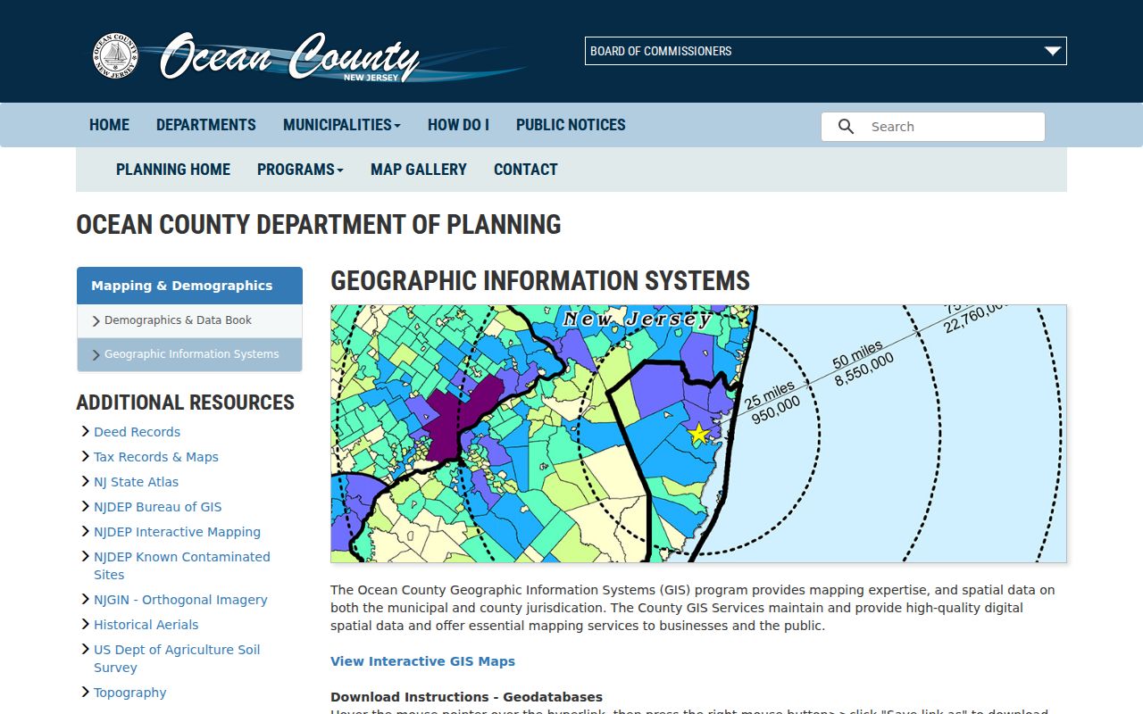
Keep the layer's vintage with any block notes. A current parcel layer and an older building-footprint layer describe different dates and should not be treated as the same record.
Note: GIS supplies the physical setting; tax and clerk records supply separate parcel and recorded-document evidence.
Lakewood Township Neighbor Parcel Details
Lakewood Tax Listing exposes Block, Lot, Qual, Property Address, and Owner Name. The county tax search adds municipality, property class, and property location. These are useful fields for checking one parcel at a time. The public interface does not promise a full occupant list or a complete historical chain. Ownership can be held by an entity, trust, or estate, and it should not be equated with someone living at the site.
Read two addresses separately. A situs is the physical parcel location. A mailing address is where tax notices or recorded-party correspondence go. County sale history can show grantee and grantor street, city, and ZIP independently from the property location. Preserve the separate fields, then use the legal description, which may include the municipality, block, lot, qualifier, subdivision, plat, or metes-and-bounds language, to hold a record trail together.
- Situs address
- The physical parcel location used by local tax, map, permit, and planning records.
- Mailing address
- The destination for notices or correspondence. It may be different from the situs.
- Legal description
- The recorded land description used to match deeds and parcels beyond postal spelling.
- Qualifier
- A separate Lakewood parcel-search field that can help distinguish a record.
Lakewood Township Neighbor Voter Channels
The public New Jersey voter-status tool is a person lookup, not a block map. It calls for last name, first name, and date of birth, and matching depends on the registration spelling. A result can confirm limited registration information. It cannot be used to create a map of Lakewood Township neighbors, and an inactive result does not prove that a person moved.
A broader Ocean County voter-file request takes a different route. The county requires a signed OPRA request and an Election Order for a comprehensive list. Requests are submitted by mail or fax, not email transfer; the county lists CD or printed delivery and normally states seven to ten working days for processing. Address, mailing, party, district, and status fields remain subject to the county process and redactions. Protected addresses must be respected.
Lakewood Township Neighbor Community Layers
Community material can add local geography, but it is not a substitute for public parcel records. The Lakewood Civic Association documents deed-restriction sections A through R, Lakewood Oaks, and Point Royale with a map and summary sheets. The inspected resource does not publish a member directory. Use a section label to orient a search, then confirm the parcel with official tax, GIS, planning, or deed material.
| Community resource | Documented value | Limit |
|---|---|---|
| Lakewood Civic Association | Section map and deed-restriction summaries for A through R, Lakewood Oaks, and Point Royale | Not a government parcel source or a member directory. |
| Township boards and commissions | Public agendas and minutes can name dated civic participants | A meeting appearance does not prove a home address. |
| Wheeler Room and local archives | Directories, yearbooks, maps, newspapers, and historical-reference help | Historical evidence needs a collection title, year, and holding institution. |
The Lakewood Civic Association section resource provides the documented map and summary-sheet layer.
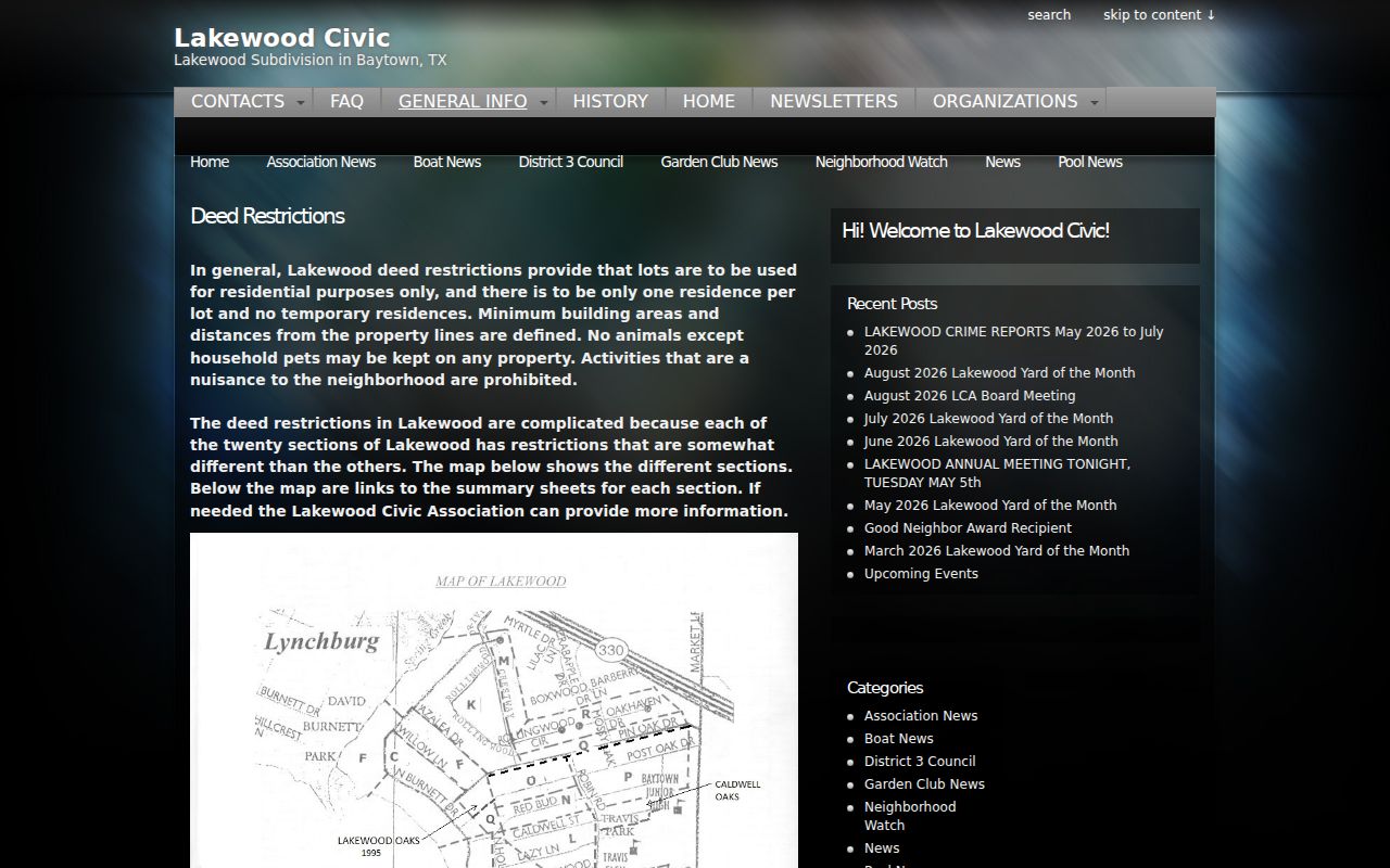
Pair a civic section reference with the block, lot, parcel map, and dated official record. That keeps a neighborhood label from being mistaken for a current-residence claim.
Lakewood Township Neighbor Sources Compared
Official records and commercial neighbor tools serve different purposes. A public tax card, GIS view, or clerk index identifies the custodian, record type, and date. Commercial services can combine public-record fragments, marketing data, and self-reported information, but their entries can be stale or merge people with similar names. Treat a commercial result as an unverified lead, never as a substitute for the dated official source.
| Source category | Strength for a block question | Important limit |
|---|---|---|
| Official parcel, tax, GIS, and clerk records | Shows a defined record type, custodian, parcel or instrument fields, and date | Each record has a limited purpose and may omit protected information. |
| Commercial neighbor tools | May suggest names or older address associations for later verification | Data can be outdated, incomplete, or misattributed and lacks custodian-level proof. |
| Library and civic collections | Can add historical map, directory, and community context | They are dated context, not a current block roster. |
Lakewood Township Neighbor Records Need Dates
A block inventory needs a date beside every source. Ocean County advertises a 2025 Parcel and ModIV geodatabase but a 2015 building-footprint geodatabase. A visible building footprint may therefore be older than the parcel context beside it. Planning approvals are grouped as 2000 through 2009, 2010 through 2019, and 2020 to present. Each layer and document describes its own point in time.
The same issue applies to recorded instruments. SearchNG's online official-record index begins April 1, 1977, while older books and images require office or archive follow-up. A deed date, recording date, sale date, or tax assessment year is not interchangeable with a present address check. Keep the date and the exact source with a block, lot, party role, or legal-description note so the record can be interpreted later.
Lakewood Township neighbors can change, parcels can be split, and records can be corrected. A dated trail is more useful than a single undated name association.
Lakewood Township Neighbor Research Channels
Online results are one access route, not the entire record trail. The Ocean County Clerk's Northern Resource Center at 225 Fourth Street in Lakewood provides a local county-clerk access point, while the principal clerk location is in Toms River. SearchNG images are unofficial and watermarked, so certified copies and pre-1977 follow-up belong with the clerk office. The county records-and-forms route also provides written-request and document-drop-box information.
For historical context, Ocean County Library's Wheeler Room in Toms River holds old directories, phonebooks, yearbooks, maps, atlases, and genealogy material. The Ocean County Historical Society Research Center maintains a reference library, family-name files, obituaries, and other research material. Those collections can supply a dated location or name trail, but they still need to be paired with the parcel and legal record for a Lakewood Township block question.
Lakewood Township Neighbors and Privacy Limits
Property records do not ordinarily enumerate household members, visitors, utility customers, or delivery recipients. Motor-vehicle address information is not a public shortcut under DPPA rules. OPRA custodians must protect identifiers and addresses where another law, court rule, or privacy rule requires it. Do not ask a custodian to create a new compiled resident list when the agency does not maintain one.
New Jersey's Address Confidentiality Program uses a legal substitute address for eligible people facing specified safety threats. Daniel's Law can also require suppression of protected personal information. A missing address or redaction can be intentional. Do not try to reconstruct it from historic images, cross-reference it elsewhere, or republish it.
Note: A dated parcel record is evidence about land and recorded interests, not an invitation to monitor a person.